Hello my friends. We are overdue a catch up. It’s a cold, rainy Sunday so the perfect time to sit down and share what’s been going on in my corner of the world.
The short answer is…A LOT!
ON THE WORK FRONT

On the work front, January in the fitness industry is no joke and my days have been jam-packed with all the regular things like teaching classes and training clients but also with leading trainings and workshops and getting through annual staff evaluations. I manage a team of 20ish instructors at The Health Club and it’s eval season!
I’m not sure if I’ve officially shared this but I have a part-time salaried role as the lead for everything that happens in our FlowFit room – power yoga, sculpt, restorative, etc. We offer about 45 classes per week. We run it kinda like a mini yoga studio within the gym! As part of this role, I’m also on the leadership team at the gym and the work is SO fun and rewarding. 10/10 obsessed with and happy at The Health Club! We are celebrating our one year anniversary of being open in February and it’s been an amazing year of growth, connection and creativity. I cannot wait to see where the future takes us!

I was also tasked mid-December with creating, testing and launching a new strength format to be launched in the new year (yes, you read that timeline right!) and WE DID THE THING!
Here’s the class description!
All Strength, No Cardio. Strong 50 focuses solely on strength training – utilizing heavy weights and timed intervals for a challenging and effective full-body workout. Our instructors guide you through movements emphasizing time under tension to build muscle and transform your body. While cardio improves fitness, lifting weights leads to lasting physical change!
The class has been so well received by our members and classes have been packed out. I’m currently in the process of training other instructors to be able to teach the format.

While I am at The Health Club pretty much full time between FlowFit lead, personal training and teaching, I’m still involved at Charlotte Yoga. I currently teach five classes a week there. I was only teaching three yogas and that felt so perfect but we launched sculpt at our original location at Parktowne in January so I agreed to pick up a couple of sculpt classes to help get that off the ground. Yogis have been LOVING it and I’m happy to get some weights into their hands.

I’ll be traveling to Johnson City, Tennessee next weekend to lead a continuing education weekend for yoga teachers at Real Hot Yoga. I’ll also guest instruct a few classes while I’m there – power yoga, flow and lift and yoga nidra. We have a full roster and I am PUMPED!

And then two weeks later, I’ll be leading an assist training at Charlotte Yoga to help yoga teacher advance their hands-on assisting skills. I’m pumped to be bringing my friend Rodney along as a special presenter. His assists are LEGENDARY!
ON THE RUNNING FRONT

I’m trying to run as consistently as I can but it’s a challenge given how busy I’ve been with work AND how much I’m using my body for work right now. When I teach formats like yoga and strong 50, I don’t have to do it with them. But formats like sculpt and flow and lift require a ton of demo and participation. Especially sculpt because I teach it beat-based. It can be taxing on my body, especially since almost all of my classes are heated.
I have been been able to run two or three days a week. Most weekday runs are in the 4-6 mile range and trying to go a little longer on the weekends.

I recently signed up on a complete whim for Moab Run the Rocks after messaging back and forth with the race director and getting a pretty sweet hookup on registration. I couldn’t say no, haha. It’s hosted by TransRockies Race Series and that’s who I did my Colorado race with over the summer. They excel at well-organized and FUN stage races. This one is three days so I’ll fly out to Utah for a long weekend of trails…and I cannot wait!
I will not be camping for this stage race and I have to say I’m looking forward to sleeping in a bed at the end of each day.

The biggest kicker? It’s March 6-8 so just right around the corner! Ahhh! I’m not going to have a ton of time to formally train but I’ll do what I can. I’m doing the “full pint” and this is what it looks like:
- Stage 1: 12.2 miles, 997 vert
- Stage 2: 26 miles, 2200 vert
- Stage 3: 13.5 miles, 1135 vert
The overall climb isn’t crazy but the mileage on Stage 2 will be a grind. The good news is that we have eight hours on course that day so should be totally doable. The great thing about these types of trail races is that you can blend a lot of power hiking in so I’ll likely go 50/50 running and hiking that day. And if things go way south, I can always drop to the half pint.
The biggest key is going to be getting a few back-to-back effort training pushes in so that my legs can go three days in a row for the race. I was SHOCKED by my ability to do this in Colorado but I did a good number of back-to-back weekends on the trails leading up to it. Even if I have to do it on the road or super local trails, I’m going to get it in.
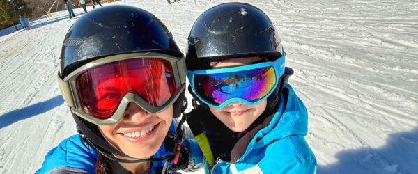
ON THE MOM FRONT

He’s just the biggest ball of joy. We had an amazing holiday season and did all the things – holiday lights, Santa, Polar Express, cookie decorating, football nights with friends, etc.

Picking him up from school is my favorite part of the day. I love having him with me and his presence at home is so warm and sweet. How did I get so lucky?
ON THE GRIEVING FRONT

Zoey arrived home to us last week and I cried all the tears again. We are doing okay but all miss her so, so very much.
Benji continues to be so subdued and quiet. I know I said this in my post about Zoey’s passing but he’s like a completely different dog. I have been taking him with me whenever I can, walking him, having him spend time with friends’ dogs and just giving him a lot of love but poor guy. It’s breaking my heart.
WRAPPING IT UP
I appreciate you guys being here. I’m not as active in posting on my blog these days but I’d love to hear what you’d like to see in 2026. Is it life stuff like this? More running content? Recipes/food? All ears!
Sending love to all.